430 Meadow Street, Rockhill Furnace, PA 17249 | Weekends: +1 814-447-9576 | Weekdays: +1 610-428-7200

Campus Map & Parking
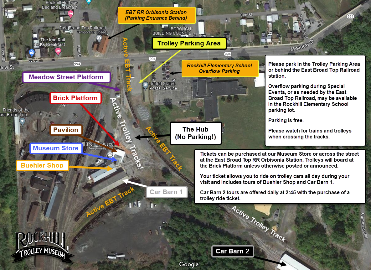
Rockhill Trolley Museum Campus Map
 Trolley Parking Area: To access the Trolley Museum Parking area, please turn beside the Rockhill Post Office building. If this lot is full, or if you are planning a train excursion in addition to your trolley ride, there is more parking available across the street behind the East Broad Top Railroad Orbisonia Station.
Rockhill Elementary School Overflow Parking: This area is for overflow parking for special events, or as needed by East Broad Top Railroad operations. (It is available for use for the trolley museum, when it is open.)
You can purchase tickets at the Museum Store or across Meadow Street street at the East Broad Top Railroad Orbisonia Station. (The Meadow Street platform is used rarely, during special events or for access by our guests with physical challenges.)
The Hub area is reserved as open space to walk between East Broad Top trains unloading and trolleys boarding at the Brick Platform. (Please note, this area is NO LONGER being used as A PARKING LOT!)
The Museum Store, Pavilion, and the Brick Platform are located on the southwest corner of The Hub. The Museum Store is open during our normal operating days and hours (11:00 AM and 4:00 PM). The Pavilion is accessible to anyone with a trolley ticket.
Car Barn 1 and the Buehler Shop are accessible during your visit, with guided tours possible.
Car Barn 2 tours are offered daily at 2:45 with purchase of trolley ticket.
Click here for a stand-alone, printable rendering of this map (.jpg, 359 KB).